SPRING 2023 RUNOFF
HIGH FLOWS
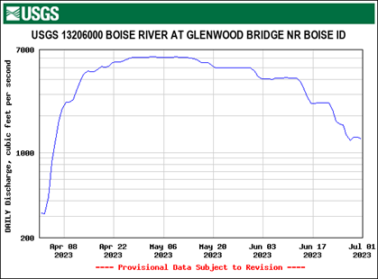
The Boise River experienced high runoff this spring with flows staying above 4,000cfs for 2 months and reaching “bank full” flows of 6,000cfs for 2 ½ weeks. High runoff is a healthy part of the lifecycle of a river as it helps clean the bottom of accumulated debris and improves trout spawning habitat by redistributing smaller gravels. On a naturally flowing Freestone river, high water refreshes trout spawning habitat with new smaller gravels from upstream, however, on a Tailwater river like the Boise River, these new smaller gravels get trapped upstream behind the dam (Lucky Peak) which keeps them from refreshing the trout spawning habitat below the dam, which is why BVFF and TU have been doing gravel augmentations in the Boise River.
At "bank full" flows, the Boise River does harvest some smaller gravels from the banks and islands which improves trout spawning habitat in some places. We will be able to quantify that this fall when we do our annual Brown Trout Redd Counting and Mapping project. It will be very interesting to see how the high-water event impacts brown trout spawning, but my expectation is we will see an increase in the number of redds on the Lower Boise River. Watch for our Brown Trout Redd Surveys this Fall and come see for yourself!

GRAVEL AUGMENTATION
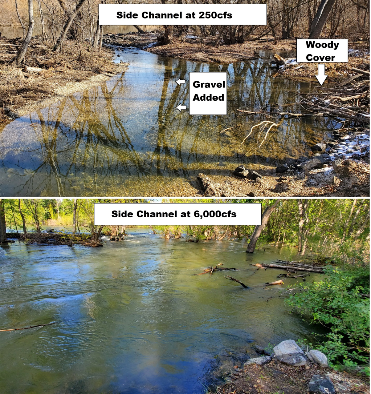
In February of 2023 BVFF added 15 cubic yards of spawning gravel on the inside bend of a side channel of the Boise River. On a normal runoff year we would expect most of the gravel to stay on that inside bend, but on a high water year like 2023 Mother Nature is going to relocate it downstream (Mother Nature knows what she is doing and is very good at placing it in locations that are suitable for trout spawning). The below photos show the gravel augmentation location at winter flows (250cfs), in May at 6,000cfs, and then in August at 650cfs. At 6,000cfs you can see water coming into the side channel across a wider area, but the river velocity is still significantly less than the main river channel and there are plenty of soft-spots behind the woody cover for trout to shelter.
GRAVEL RELOCATION
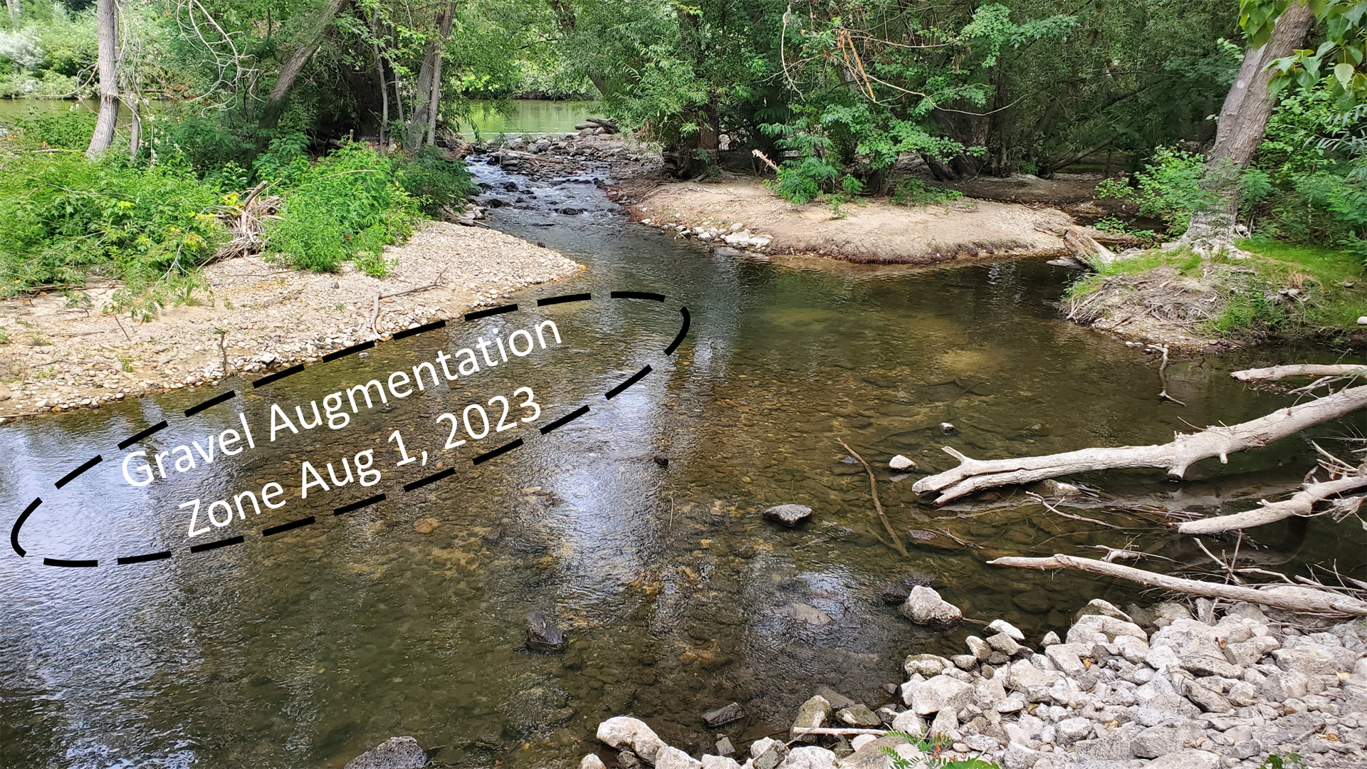
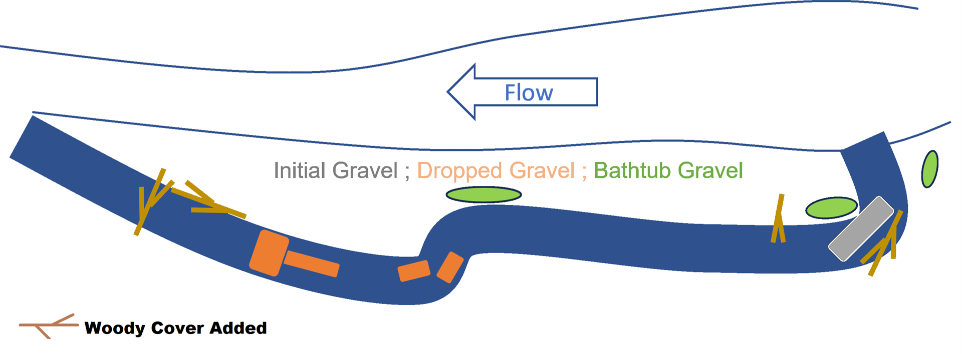
Flows on the Boise River recently dropped to 650cfs (a very fishable flow!!) and I walked the side channel to see where Mother Nature decided to relocate our gravel. The good news is that the gravel is still in the side channel and Mother Nature left it in good locations for trout to use for spawning! The figure below shows the side channel, the gravel augmentation location, and where new gravel has accumulated. It is impossible to identify our gravel from natural gravels, but I can say that there are significant new deposits of small gravel about 500 feet downstream of our augmentation-zone, below where the side channel has an “S Curve”. This is a typical location for the river to drop gravel as they like to drop it on the inside bend where water velocity is reduced, which is one reason why sinuosity is important to a healthy river (sinuosity is a measure of how many curves a river has). And because the flows were so high, some gravel was dropped above the normal summer high water mark, leaving a kind of “bathtub ring” in some locations. This bathtub ring effect can also be observed in the entry area of the side channel from new gravels being dug up from the water spilling over the banks.
WOODY COVER
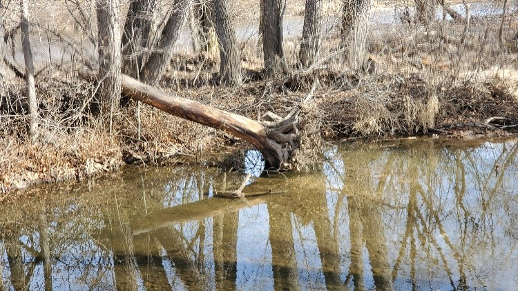
As a part of our trout habitat improvement work on the side channel we worked with IDFG and the Boise Flood District to incorporate woody cover to give trout fry shelter (shown in the figure above and the photo to the right). Woody cover is just as important to improving the trout population as spawning gravel. Early observations this summer have shown some rainbow trout fry in the side channel and we hope to join IDFG on their annual Trout Fry Survey later this fall to see how the juvenile trout handled the high flows. The large pieces of woody cover that were anchored are still in place but some of the smaller pieces were carried away by the high flows and could use to be refreshed and anchored.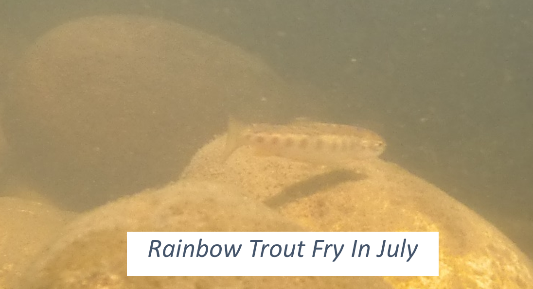
The high water event left some debris at the entry to the side channel and broke through the nearby New Dry Creek diversion dam, dropping the water level and reducing flows into the side channel. At 650cfs we are getting about the same inflows to the side channel as we did at 250cfs last winter. We will be doing some maintenance on the side channel in August to help clear debris to improve inflows and improve the woody cover. If you are interested please sign up for the event posted on our website.
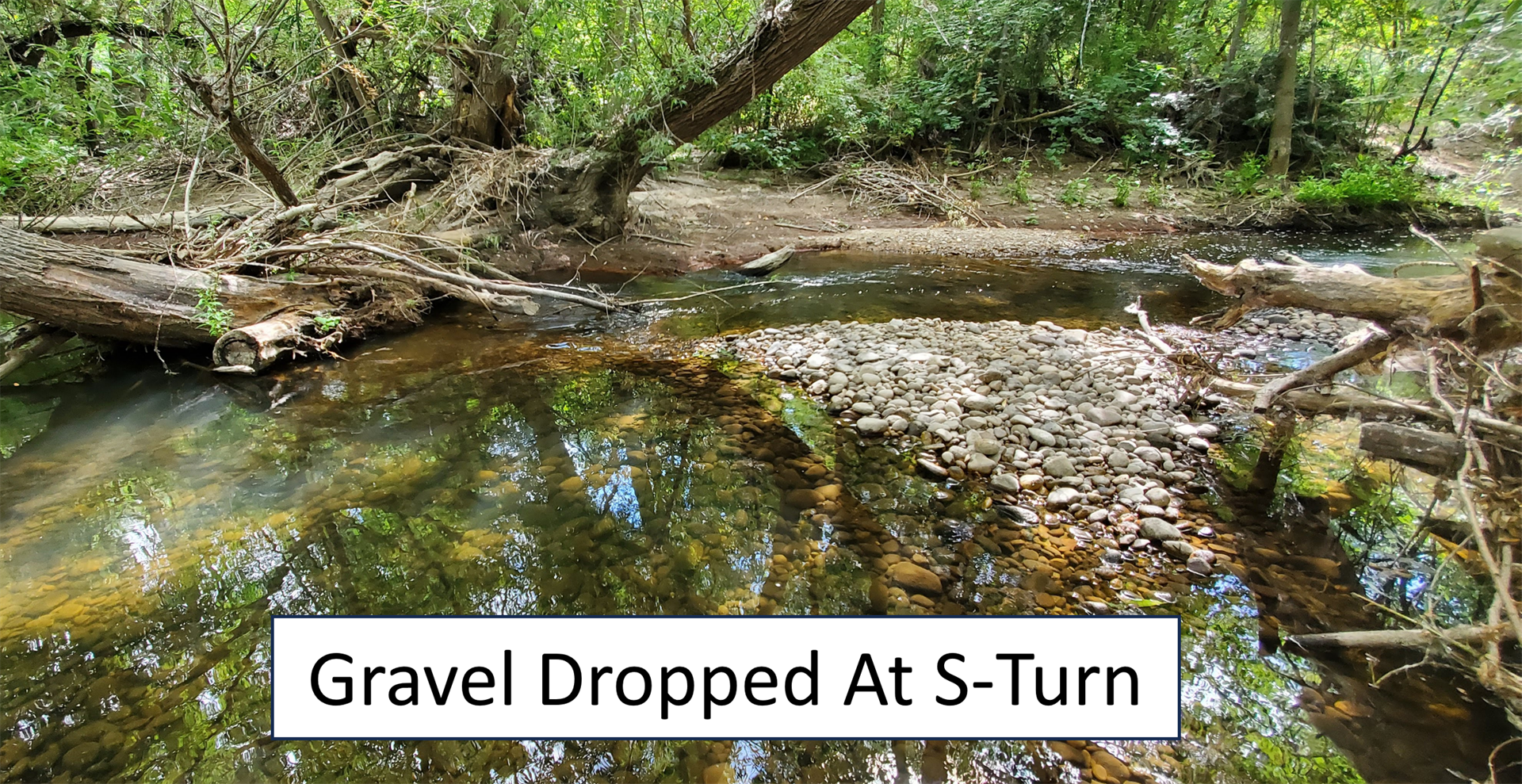
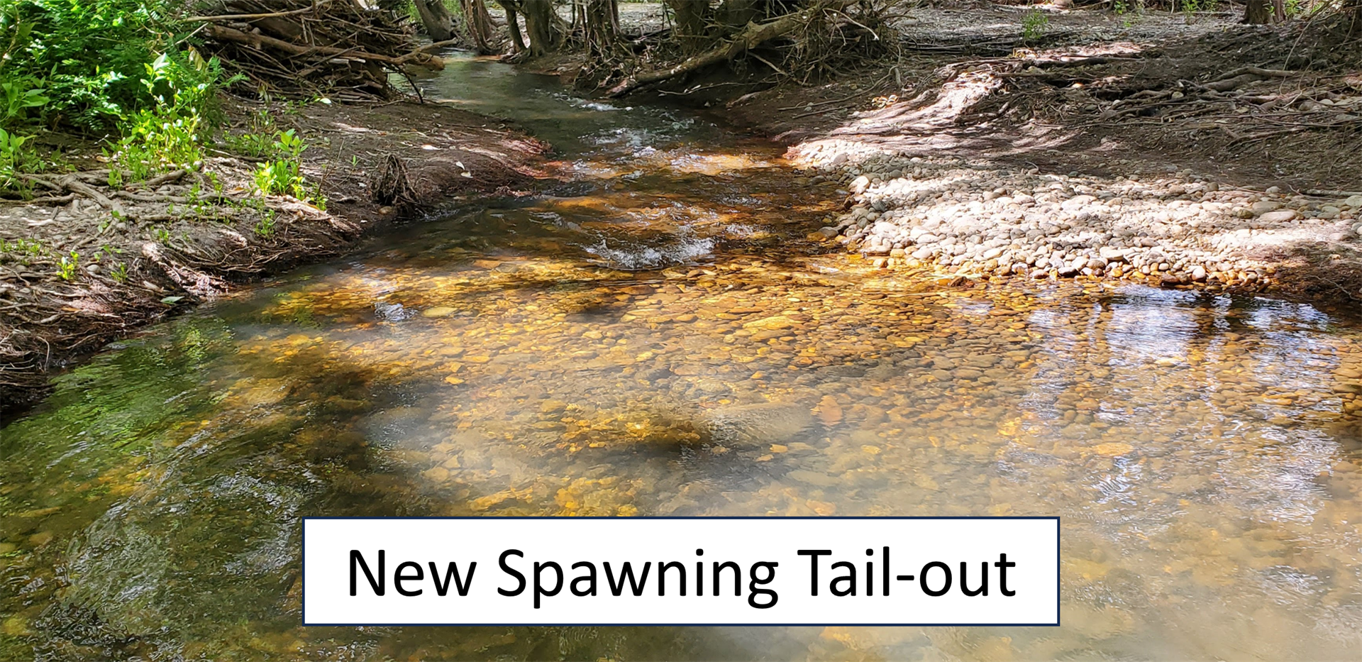
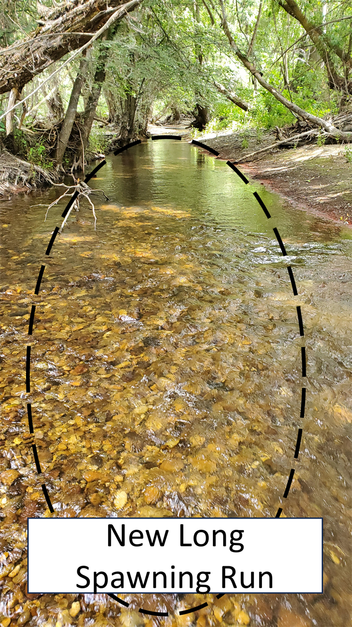
TERRAFORMING
Below are some examples of how Mother Nature “terraformed” the side channel and where she moved our gravel. There is now good spawning gravel in the S-Turns and the tail-out below that. Before high water there was a 100' long narrow trench with a bottom of large cobble. That trench is now filled with spawning gravel and is an awesome long spawning run! Some of these locations are more suitable to rainbows to spawn at higher flows and others are perfect for brown trout spawning at lower flows. We will continue to monitor the side channel for spawning activity and report what we see.
THANKS FOR THE HELP, MOTHER NATURE!